Reloaded Blog

Sunday, September 24, 2006

Sydney Bushfire and More of Spring


Finally back home and went on a few more walks. Sadly there is an early start to the bushfire season in Sydney. I have been analysing using the RapidFire Modis site. Here are few pictures and details.

Sunday, September 17, 2006

Spring is here


Finally the fresh sunshine of spring is here. With all the warmth and rich smells of flowers. I went for a walk and took photos of wildflowers and some in gardens to make a "spring collection". Here are a few unedited shots of what I think looks good.

Tomorrow I am off to Canberra for a Homeland Security conference, I hope I can find homes for rich and thin clients in government departments and gain support for partially home grown technologies. WorldWindJ may become available in Eclipse RCP making it much more fun as well as adding a "traditional" GUI to it.

Monday, September 11, 2006

ISS-Atlantis Docking

I have been following the Atlantis flight from launch. Obviously due to lack of anything better to do except check its postion against WorldWind satellite tracker. This screenshot shows it being exactly where it should be over South America and the orbital sunrise coming up. I have also been experimenting with some direct show and live video streaming into Worldwind from VLC. I will love to have Video on Terrain quite soon.

Saturday, September 09, 2006

Friday night out


Went out on Friday night in Adelaide. Amazing how much fun you can have in a small town if you are bent on it.

I have been doing some web development for some extra cash. Basic blogging and news setup stuff for AADI. Not flashy at all but I am glad to see more and more corporations are following the employee expression philosophy.

On the Worldwind front Stephan has been doing some very good work on the Download/Texture loading optimizaton front. We may even end up with true streaming like Skyline or Google Earth use using ECWP or JP2K techniques. Adam Hill is taking up the WFS code I started and optimizing it. Nice to see such a good team coming together.

Also all praise Canon Australia, I sent my Canon IXUS I for repairs after it had an E18 error and they promptly replaced it with a brand new one complete with all the accessories. That is good service and warranty. Here are a few shots of some previous revelry I have been meaning to post. Aren't they pretty ?

Tuesday, September 05, 2006

Model Feature and Hybrid Machines


Having a hybrid portable machine increases productivity a lot. I can conceptualize on the tablet and code on the laptop and stay on the net via 3G .

Anyway after recoding on some prior work by Mashi I have 3D Textured Models. Just need to work on animations and pixel/vertex shader enhancements.

Sunday, September 03, 2006

Finally "Somename"s via Geoserver WFS


I admit it's far from finished, but finally I am moving things along from the time they were stalled a year or so ago in terms of streaming Placenames from a WFS.

As ususal the major straw breaking the camel's back in terms of Placenames is the lack of unicode support on various fronts.

  • Worldwind does not support Unicode Placenames

  • Geoserver 1.3 on CentOS does not support Unicode Fields in Shapefile DBF


These problems only showed up since I started with Brazilian Placenames which have Portuguese characters.

I have made my best effort in these imperfect state of affairs. I hope the Geoserver crew and
the Worldwind rendering crew come to my rescue. Meanwhile you get "Somename"s over Brazil.

Saturday, September 02, 2006

Placenames via WFS and Blogging from hilltops


The WFS placenames support in World Wind is nearly there. a few minor tweaks and fixes and we will have dual mode point data, from cache and from wfs, not to forget KML .

I finally found time to take all my toys together to a spot I like, on top of the hill overlooking the small town I live in. Nice and windy, in the shade of Eucalypts this post was written entirely using a GPRS Modem and pen input on tablet.

Wednesday, August 30, 2006

Toshiba M400 and Jumping for joy


Finally finally my new Toshiba M400 tablet is here. A laptop decent enough to run Windows on. I can turn it around, fold it up into a neato tablet for sketching and concept art. Expect me to start posting my concepts and sketches soon. For now here is a picture of the Model I got.

I have ideas about using the harddrive motion sensor to navigate Worldwind as well.

Monday, August 28, 2006

Ossim

Ossim which is Open Source has a Image Chaining and Parallel processing architecture, it is just not marketed with as much zeal, in production environment I believe it will perform just as well if not better due to the open source nature and complete customization/optimization abilities.

The screenshot shows Ossim being used to view mosaiced Sao Paulo imagery and to write it to a Tiff file in a parallel chain.

Sunday, August 27, 2006

1st Indonesian GeoSpatial Exhibition


After a week of standing around and replying to wow's about Worldwind in Jakarta I am finally back home. I have seen a lot and learnt a lot and I am really happy to be involved in a world leading open source project.

Worldwind works really well due to the cached offline mode in this case where there is really bad internet or none at all. Only a few had used it before and recognized it on sight, some computer science students wanted to download it and play themselves, with the large population base there is bound to be a few talents floating around, a bit of organized development cannot hurt.

Monday, August 14, 2006

Finally the Embedded Browser


Axient has made some good improvements on the look of the Embedded Browser. There are still a fair few bugs but make up your mind on what looks better and is more open. Digital Globe Imagery is only 1 Php Script away, just to make the "I can see my house" folk happy.

Brazil Imagery and Ossim


The other open source globe that I have had some contact with deserves a mention on this blog. It is OsgPlanet (Open Scene Graph Planet) or Ossim Planet or simply planet. It is currently in a very alpha state but has two dedicated and one part time developers. In addition it has solid graphics, remote sensing and data processing backbone, being built on gdal, proj.4 and Open Scenegraph.

I have been painstakingly compiling it on linux (frustrated by some library errors). Now I have the viewer/processor application for rasters, imagelinker built. I loaded up some new Brazilian 50cm data we are processing for Worldwind in it and it looks really good. This combined with the Vector Capabilities of Qgis will make a really good application.

May be I can set up a processor chain to tile Worldwind imagery and terrain in Imagelinker.

Saturday, August 12, 2006

Feeling Small and yet you have the World at your finger tips


This is sort of like the inside is bigger than the outside scenario. This image makes me feel so small.

Yet I regularly play with Worldwind and I am sort of addicted to spinning the Globe.

With the new Widget code from Nigel we can easily add time controls and control Space as well as Time in Software of course, which the entire universe might actually.

Forgot to mention, now you have a HOW-TO to import your little patch of Earth to Worldwind using Dstile.

Tuesday, August 08, 2006

Virtual Earth is set to near Google Maps


Well granted Orbview and Ikonos are not 60cm satellites like Quickbird but there are two of them now operated by GeoEye( merged company formed by Orbimage and Space Imaging) and from the sounds of it Microsoft has similar exclusive rights as Google has with Digital Globe to stream the archive of these two satellites.

There are signs of this data coming online via Virtual Earth.Meaning it will transparently flow into Worldwind. Microsoft does not even have the immediate need to make 3D spinny globe to show it off. Well then again they did make Flight Sim and now Photo Synth.

Enjoy the Imagery.

Saturday, August 05, 2006

Track Seal in GE, Track Geese in WW


Another exciting weekend. Bottles of Cointreau and Bombay Gin vanishing down the throats of girls. I think Australian ( and some French) girls will beat anyone at drinking.

If I remember there was an article about tracking Seal in Google Earth. Now they are tracking Geese in Mongolia in Worldwind as per this forum post.
Following the thread you will realize how a plugin was developed for exactly the purpose the user wanted in days by the community. This is the flexibility that World Wind offers. Time for a screen shot.

Friday, August 04, 2006

Worldwind KML Capabilities

On Chad Zimmerman (Earth is Square's) request I am putting together a list of supported KML Features in Worldwind 1.3.6. These have been developed by Tim(Shockfire), Chris(dumdumhead) and myself in a rather ad-hoc and as needed basis. This list may not include all combinations or recursive capabilities.


  • Point Placemark support: Lookat and Description pop-ups are enabled. Time based play-through is also supported. Look at the samples here.

  • Linestring, Polygon and MultiGeometry Support: Worldwind renderer is slightly diffrent so appearances may differ. Lines may be textured on the side.


  • ScreenOverlay support: This was developed to support legends and can be used in KML as well.

  • GroundOverlay support: This is via the ImageOverlay code.

  • Folders, Networked KML and Referenced KML support.

  • Blue icon pallette for existing Yellow Google Icon set. User specified icon pallettes can also be used.

  • KML Drag and Drop support.
I will be adding screenshots and sample files to try to this post.

In addition you can load textured Direct X models. A Model tag is in the works to make this easier.May be even Collada models will be supported and all the Quake formats.

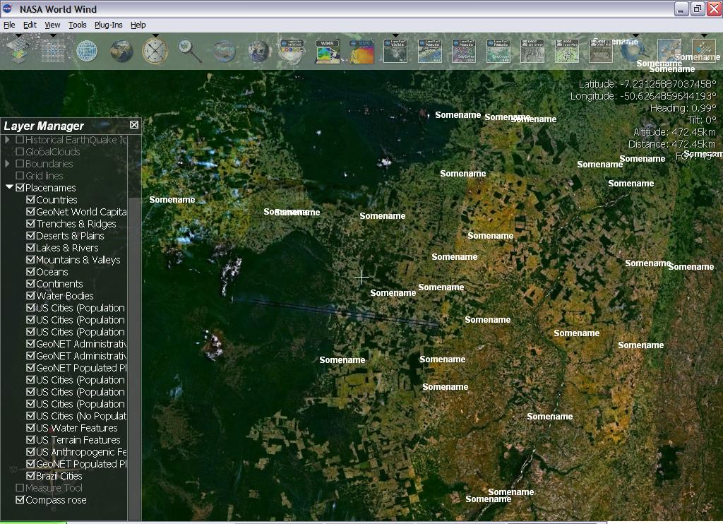
In Worldwind you can also make massive Data and Terrain overlays using Quadtilesets and HigherResolutionTerrain subsets respectively.

KML can also be used via a push mechanism over Jabber, UDP or any other protocol as opposed to a pure polling method.

Please leave comments on features you would like to see and how you can support us.
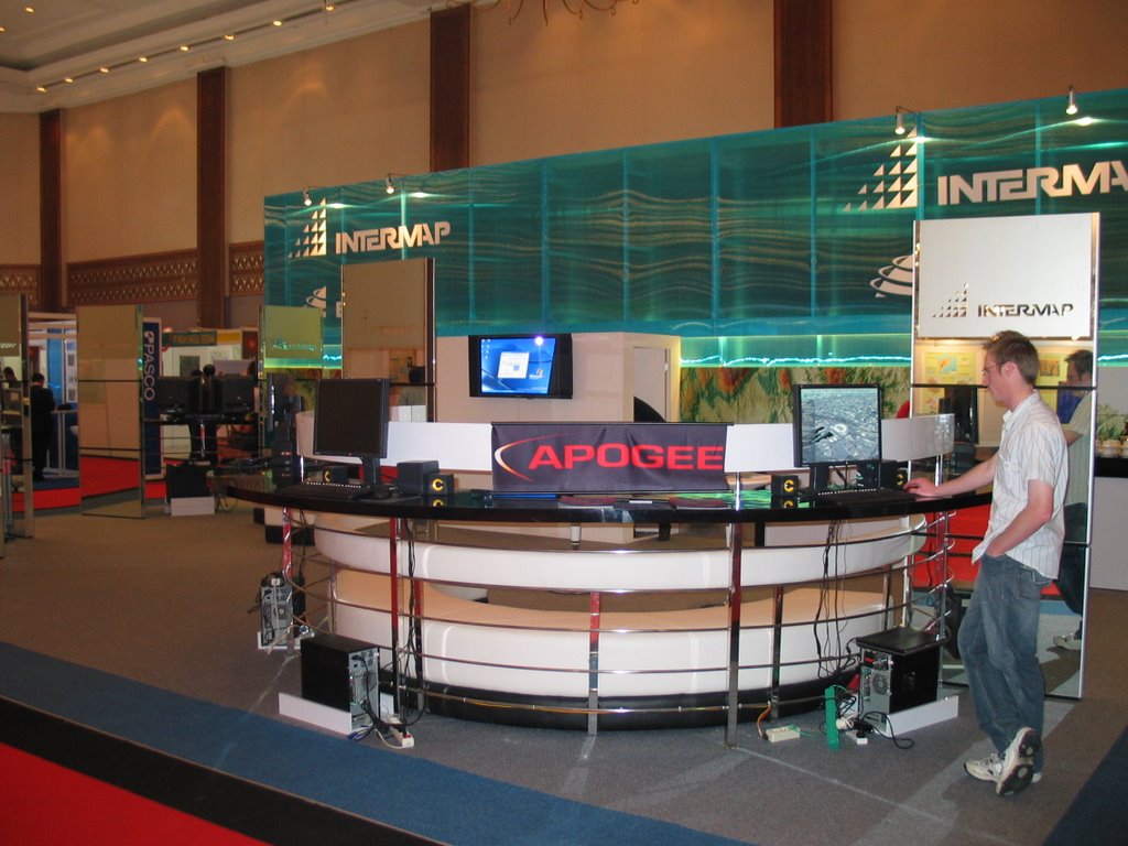
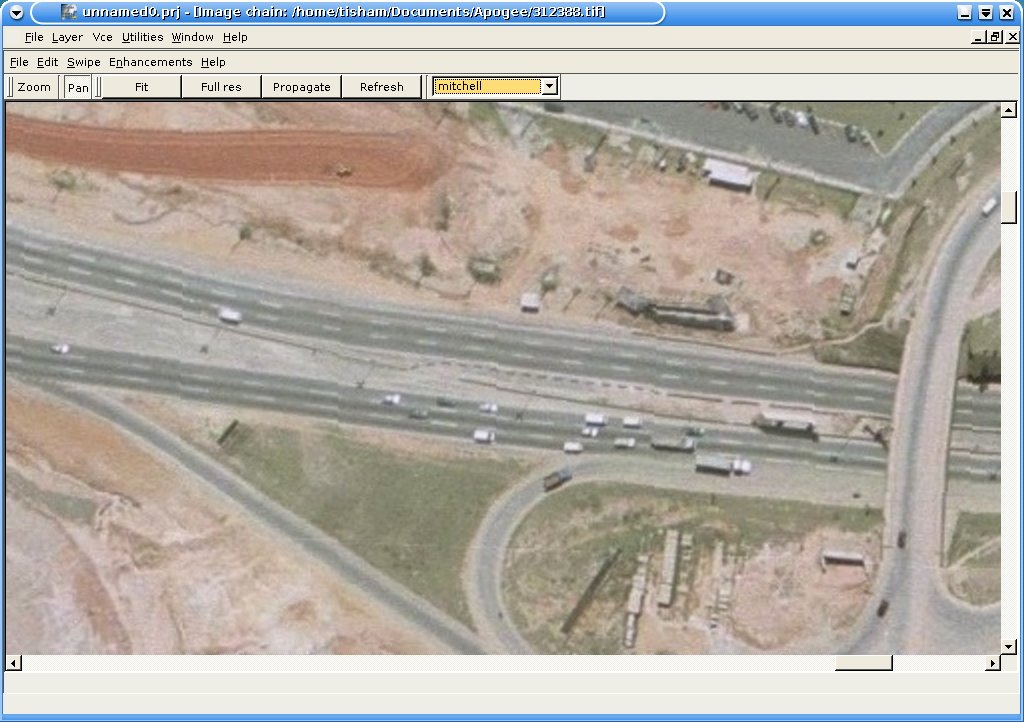
Thursday, August 03, 2006

Digital Globe and Google

I understand that Google Licences its High resolution satellite imagery from Digital Globe and being in the Imagery field I know that raw Imagery cost a huge lot being the major barrier for access to it for ordinary people and even people in emergencies.

This barrier is artificially kept in place by Satellite vendors such as Digital Globe and GeoEye. They only bend back for the large scale customers such as Governments and Corporations who buy 1000's of scenes and use up the capacity on the satellite. This is a good and working business model but is not certainly flexible enough for a retail user, as I would call a person purchasing a single scene. The Imagery market place needs to evolve to be friendlier to the retail user. Google with its data delivery capacity is a step in the right direction. Digital Globe should see the opportunity that exists here and exploit the marketplace. The profit margins may be slimmer but the populace will be hooked to Imagery as they are to Webcomics or Phone Ringtones. This will bode well for the Next Generation satellites such as Worldview.

Frankly the Imagery business could use a lot of streamlining and less back biting and misunderstandings on licence issues.

Monday, July 31, 2006

String of misfortunes

This week is just not turning out right. First the dread call, next the barrel of my canon IXUS broke with an E18 error which is quite painful. Thankfully I have warranty on it. The lens mechanism is apparently quite fragile as I have come to find out from various posts.

Hope to get it fixed soonish. Not feeling like spending any money since I can see big expenses in the horizon. Save me from the clutches of the lawyers.

Proxy Tilers and Linking Policy

Google maps explicitly states that if you embed Google Maps on your site and expect heavy traffic you have to notify them.

This does not stop Manifold from using it in their application and boasting about it. So what is the acceptable use policy with regard to Applications/Desktop clients using Google Maps data. It must be somewhere. If you leach too much Google will die on you and claim that you are a virus, which they are right about since bandwidth is being chewed up by freeloaders eager to see theirs and everyone elses house.

But, if an Open Application such as Worldwind transparently uses this data with acknowledgement and brings it to more people who probably cannot use Google Earth due to low bandwidth connections or want to operate in remote areas in offline mode, it should be encouraged since it brings the benefit of this great dataset to more important uses such as Emergency Response rather than just the Desktop Globetrotter. The community can also add bandwidth they have bought to the Dark Fibre Google owns to further ease the use of the imagery.

Sunday, July 30, 2006

Parties,Life and World

Ok great do on Friday. Jive and Barbecue and Drinks. Happy birthday Helene.
It was perfect till I got a dreaded call I have been expecting for a while. Hopefully the storm will blow over.
KML Support in Worldwind is coming in leaps and bounds so are graphics goodies.


Sun shading


KML support

I am also planning to bring the RAT project to sourceforge and a wider community.Watch out for simple folks knowing SAR.